Meet at the Caversham end of the Caversham tunnel. We’re going to look at different possibilities for a safe and sensible route from the Caversham end of the Caversham tunnel into the CBD. Coffee or lunch in town afterwards.
I’d love to be there, unfortunately the timing is terrible for me.
It takes me a wee bit less than 2 hours to ride from A to B, so I presume you have some fun activities en route, or are getting there in a roundabout fashion
@GerardH - any chance this suits you? And do you happen to know the options that have been considered for this end of the trail? I’ve also reached out to the DCC to that end.
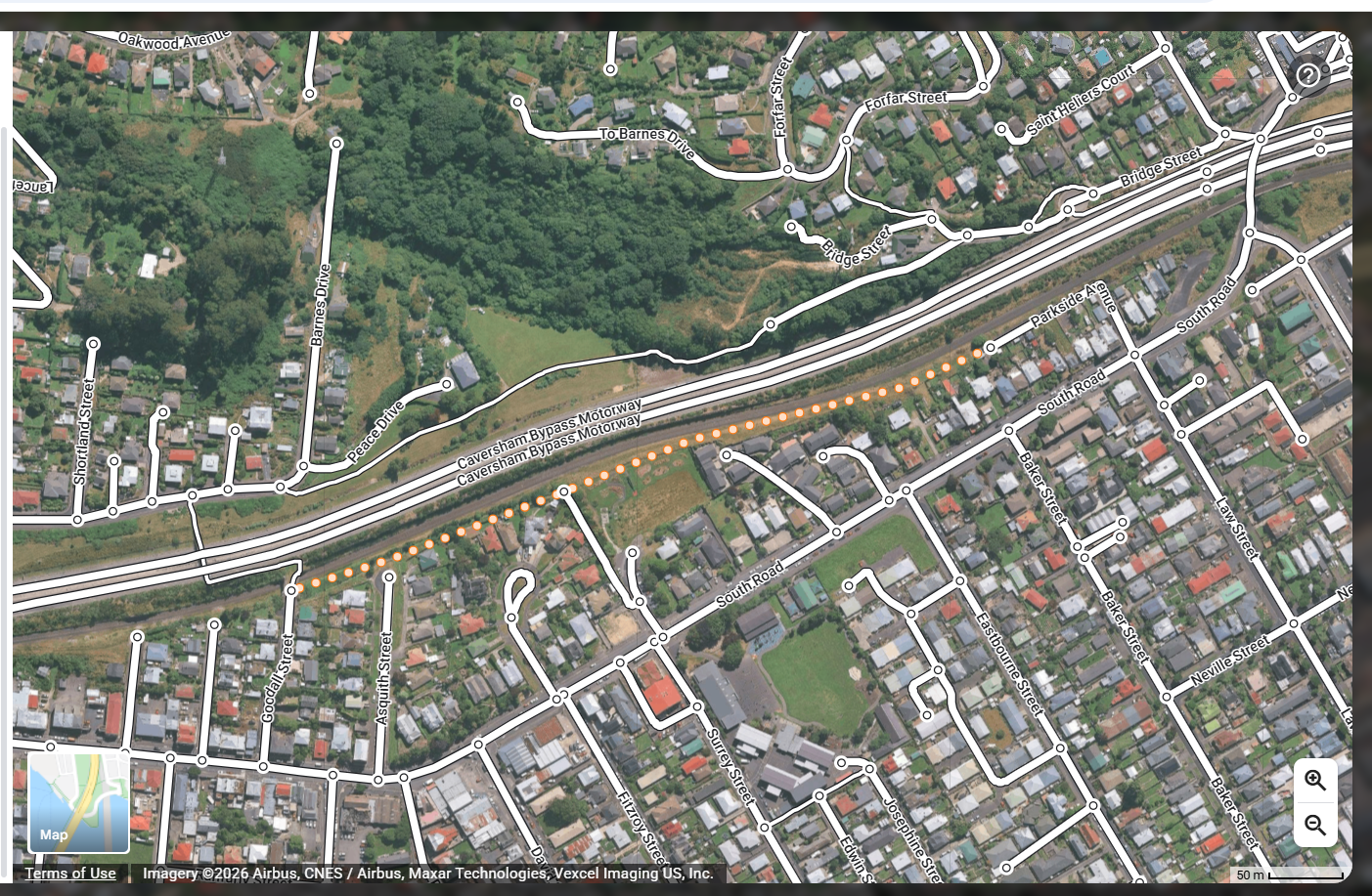
Should be good to attend (that’ll be my exercise for the day from Opoho!) From the Caversham end, there are existing connections to Caversham (via overhead bridge) but the link to the Octagon I’m less sure of. Certainly to the corner of Glen & South Road is easy - existing path - but from there it gets hazy.
The DCC cycling info has us cross South road via the gap in the islands, continue up past the bottom of Eglinton road, then down past the Southern cemetery. Many people prefer to use the pedestrian only footpath, crossing over to the road again after the crash barrier ends on the downhill stretch.
Their suggested alternative, if one wants to avoid hills, is to turn left onto South road, ride down past the Glen then left again onto Burns street. Another left takes you onto Neville street “around the famous Carisbrook rugby stadium” then continue on to the Oval via Wilkie street, left into King Edward street and continue onto Princes street
Personally I usually go via South road, as it feels faster. The other option is probably safer, though it still has points of conflict with faster moving cars along King Edward and Princes street, especially where the road narrows for a pedestrian crossing and getting from the right hand lane into the left hand lane after the South road intersection.
The pedestrian over bridge has pedestrian height safety rails, rather than the higher cycle standard. It’s not designated as a shared path.
Barnes drive is one where I’m not sure the sensors pick up bikes. It could do with a “cyclists may cycle across with pedestrians” sign.
I can confirm the signals crossing the motorway do not pick up bikes (incl. the Pedals bikes). I often hope for a car to show up to trigger these, or if I’m heading towards Caversham will just use the pedestrian button, unsafe to do so in the other direction as you have to cross an active and fairly blind lane and hop onto a tall curb.
There’s a bit of chat from the Caversham community that indicates an assumption that bikes will have relatively easy access to Caversham from the tunnels trail - is that considered as one of the target destinations in the planning for this trail? Or our South Coast beaches, w/ Caversham as a thoroughfare?
I’m keen to join, but will have to see how Saturday pans out .
Yes, we are thinking of where to direct people once they get through the Cav tunnel heading north. Strictly speaking it finishes at the Barnes Drive lights, but practically speaking we need to look at where people want/need/should go:
through the lights to Caversham?
Over the pedestrian overbridge to Caversham?
Along the cycle path to the Glen then around Neville St to Sth Dunedin?
Along the cycle path to the Glen then up & over that pinch of a hill to the Southern Cemetery then {somehow} connect to the route north?
Ideally all of the above - & able to be done by a family, not just confident riders on ebikes
Oh, and I’m a bit of a softie/fair-weather cyclist on weekend rides so if it’s raining I’ll be there in spirit
Just to add my two cents, I think Wilkie Road is the best route (especially for less confident riders) to connect Caversham through to town as it leads you right onto the shared pathway along The Oval and then easily onto Vogel St which is the best route to the centre of town:)
Unfortunately have not been on my bike as much in recent months thanks to a new job where a car is unfortunately essential, but I hope to join you all in the near future.